

Birds of Prey
Birds of prey, also known as raptors, are a group of carnivorous birds, which means they feed primarily on meat. All birds of prey have hook-tipped beaks and sharp curved claws called talons. Also called raptors, these include hawks, eagles, vultures, falcons, and owls.
Types of Hawks in Massachusetts
Here in New England, hawk is a general term used to describe birds of prey that are active during the day (aka diurnal) and fall in to two groups: the slender Accipiters and the stocky Buteos.
Accipiters
Sharp-shinned Hawk (Accipiter striatus)
The smallest accipiter, the Sharp-shinned—or "Sharpie" for short—is an uncommon breeder in Massachusetts. However, it can be seen in good numbers during migration. Experienced hawk watchers can differentiate it from the larger Cooper's Hawk by the smaller head, narrower tail and facial markings.
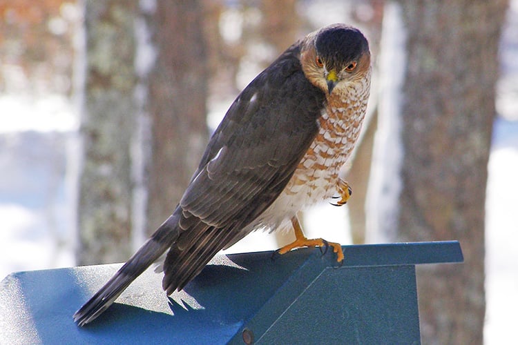
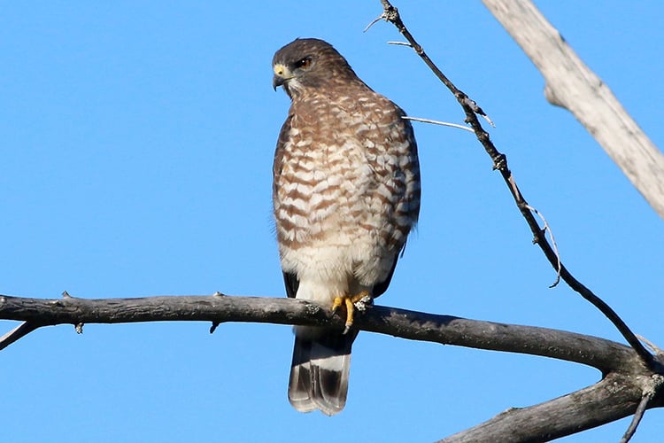
Cooper's Hawk (Accipiter cooperii)
The increase in Cooper’s Hawk populations over the past several decades has been dramatic. Once rarer even than Sharp-shinned, it has bounced back and can now be seen throughout the state. Although most at home in wooded areas, in recent years Cooper's have become more common in suburban and even urban locations.
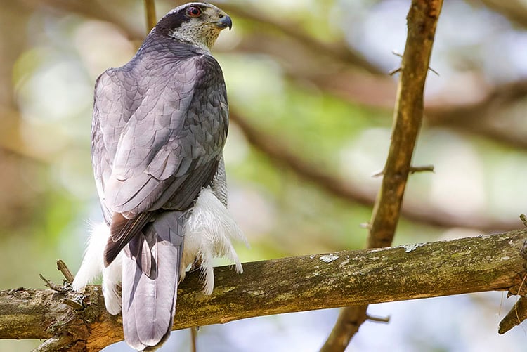
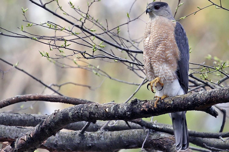
American Goshawk (Astur atricapillus)
Immatures are often confused with the smaller Cooper's Hawk, but an American Goshawk in adult plumage with its gray breast is unmistakable. Goshawks are very uncommon and are most often seen in larger forests. On their breeding territories, goshawks are notoriously aggressive and will not hesitate to attack passersby.
Buteos
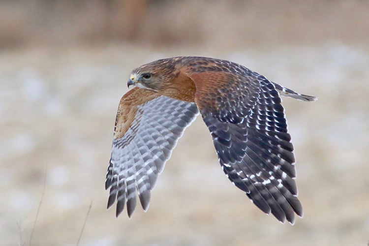
Red-shouldered Hawk (Buteo lineatus)
The buteo of the forests, the Red-shouldered Hawk can be identified in flight by the pale crescent on the tips of the wings or by its insistent "keer" call. It breeds most commonly in Plymouth and Bristol counties.
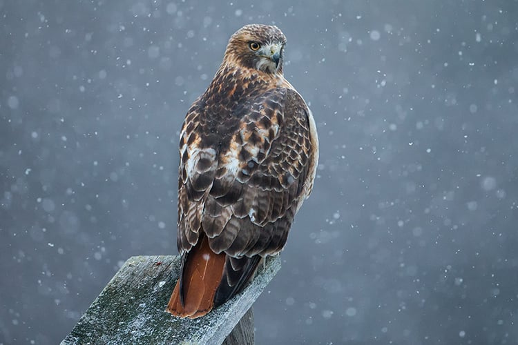
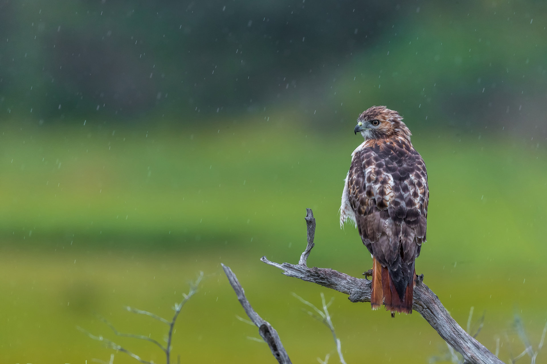
Red-tailed Hawk (Buteo jamaicensis)
Our most common hawk, the Red-tailed Hawk is seen in cities, suburbs, and the countryside. It feeds primarily on squirrels and other small mammals, and rarely presents any threat to humans or pets. Only the adults sport a red tail. Juveniles—who are the same size as adults—keep their brown tail feathers for a year after they're born. Young birds continue to rely on their parents for food for a month or more following fledging and can often be heard screeching for food (loudly) in late summer.
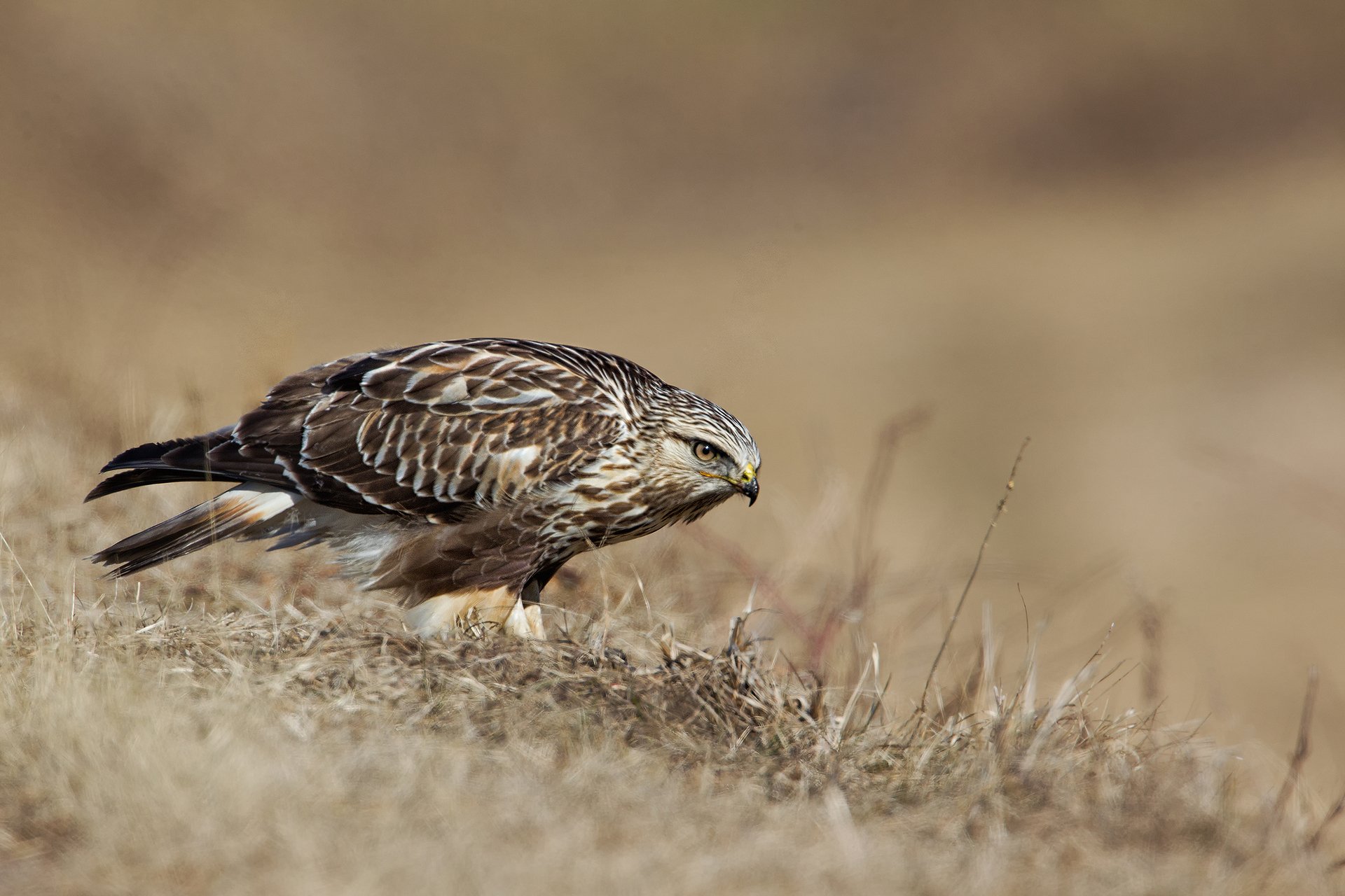
Rough-legged Hawk (Buteo lagopus)
Rough-legged hawks are arctic breeders but often move south to Massachusetts in the winter. Look for these overwintering birds in their preferred habitat of large, open fields. They are the only buteo that regularly hunts by "kiting," or hovering in place.
Broad-winged Hawk (Buteo platypterus)
During the fall, hawkwatchers congregate to witness the mass migration of the Broad-winged Hawk. With the right weather, thousands can be seen flying over a site on a single day. The migration is precisely timed, so it is extremely rare to see a Broad-winged Hawk in winter. Despite its abundance during migration, it is not a common breeder in Massachusetts and is declining in many parts of the state.
Types of Falcons in Massachusetts
Scientists used to classify falcons among the hawks, but it has more recently been determined they are actually more closely related to woodpeckers. Common types of falcons in Massachusetts include:
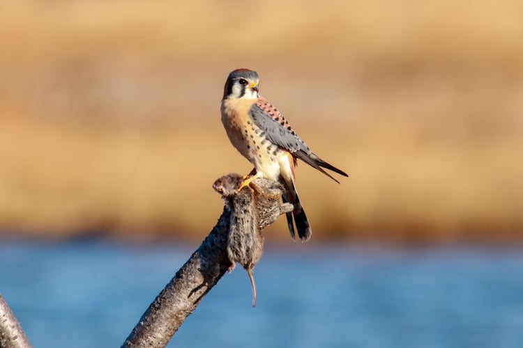
American Kestrel
The robin-sized American Kestrel is a bird of the open field, and the lucky observer might see it hovering in place as it searches for grasshoppers or small rodents. It is a cavity nester and will adapt readily to human-provided nest boxes. Sadly, this colorful little falcon is in serious decline in Massachusetts, probably because of the loss of grasslands and suburban sprawl. Learn more about American Kestrels
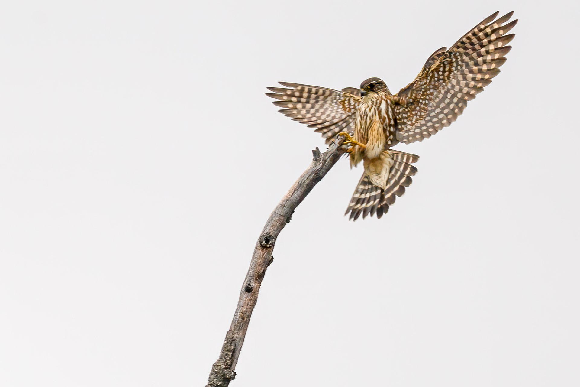
Merlin (Falco columbarius)
The merlin is only slightly larger than the kestrel, but what it lacks in size it makes up for in attitude. It feeds mostly on small birds which it can capture in midair. The merlin only recently nested for the first time in Massachusetts and is still rarely seen in summer but is regularly seen during the rest of the year, particularly in fall migration. Adult males are gray, and females and juveniles are brown.
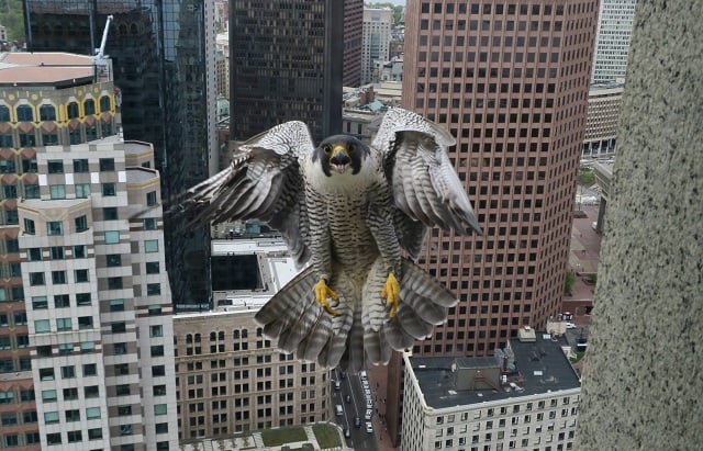
Peregrine Falcon (Falco peregrinus)
The fastest bird on Earth, the peregrine falcon was extirpated from Massachusetts in the 1950s when the pesticide DDT caused its eggshells to crack and break before the young were ready to hatch. It has recovered well, and current numbers exceed historical highs. Only a handful of peregrines now use nest sites on cliffs as they did in the past, and most nest on tall buildings or bridges in cities where local Rock Pigeons provide a steady food supply.
Other Types of Raptors in Massachusetts
There are several other birds of prey often lumped in with hawks and falcons. However, they are not as closely related from a scientific perspective.
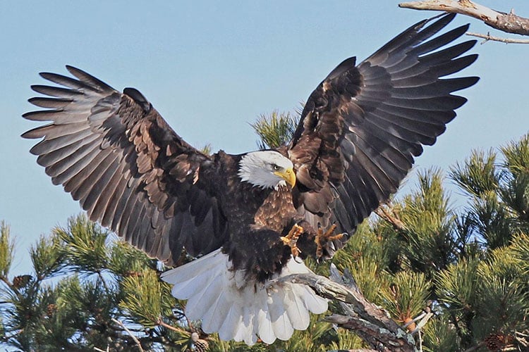
Bald Eagle (Haliaeetus leucocephalus)
Once a relatively abundant species, Bald Eagles suffered an alarming decline from the 1950s–1960s. After DDT was banned in 1972, state conservation agencies and organizations like Mass Audubon began working to help jumpstart the population. They have definitely come back, and Massachusetts has more than 80 breeding pairs. Learn more about Bald Eagles
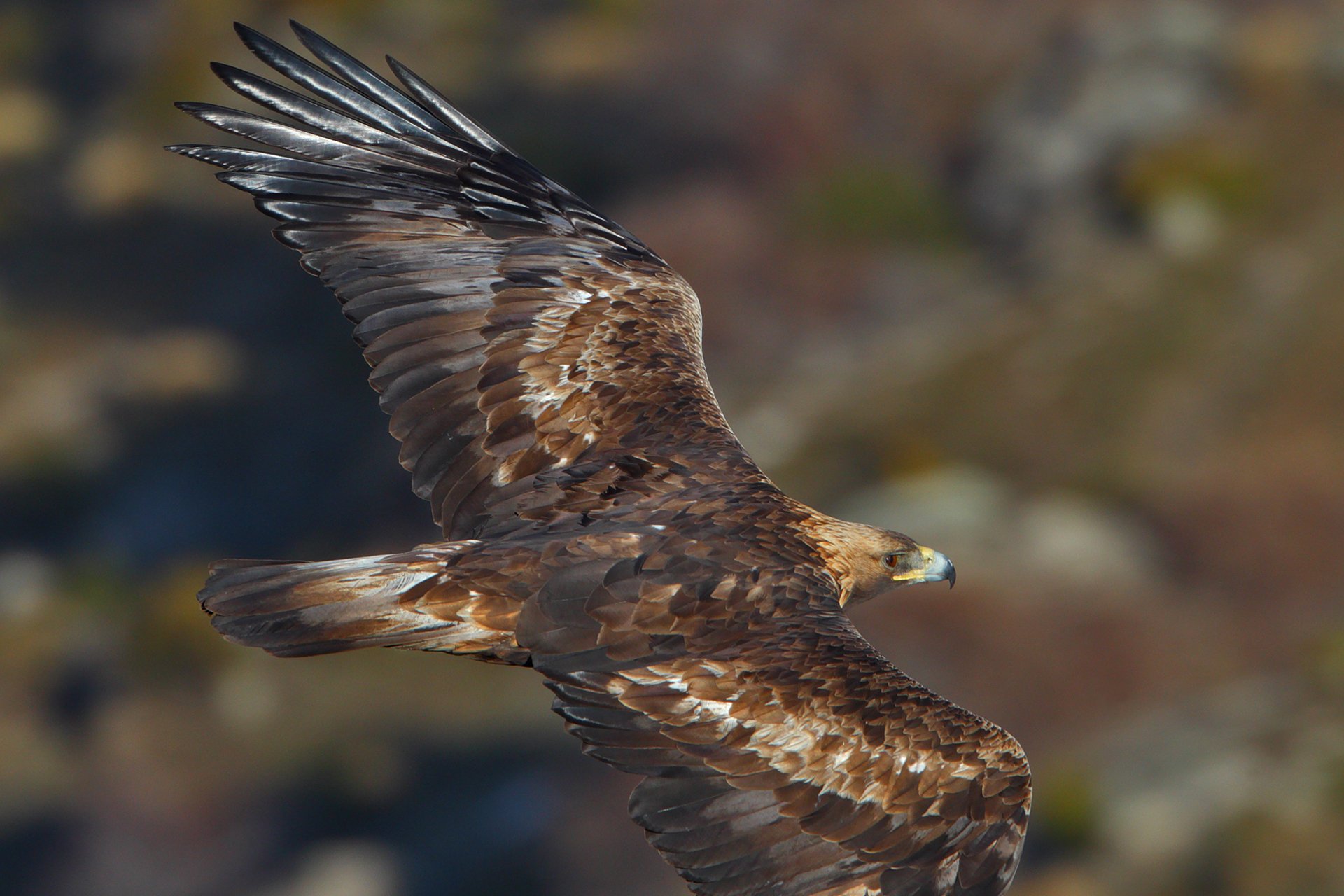
Golden Eagle (Aquila chrysaetos)
A rare migrant through Massachusetts, there are typically only a handful of sightings in any year. Juvenile Bald Eagles, with their dark brown plumage, are often mistakenly reported as Golden Eagles.
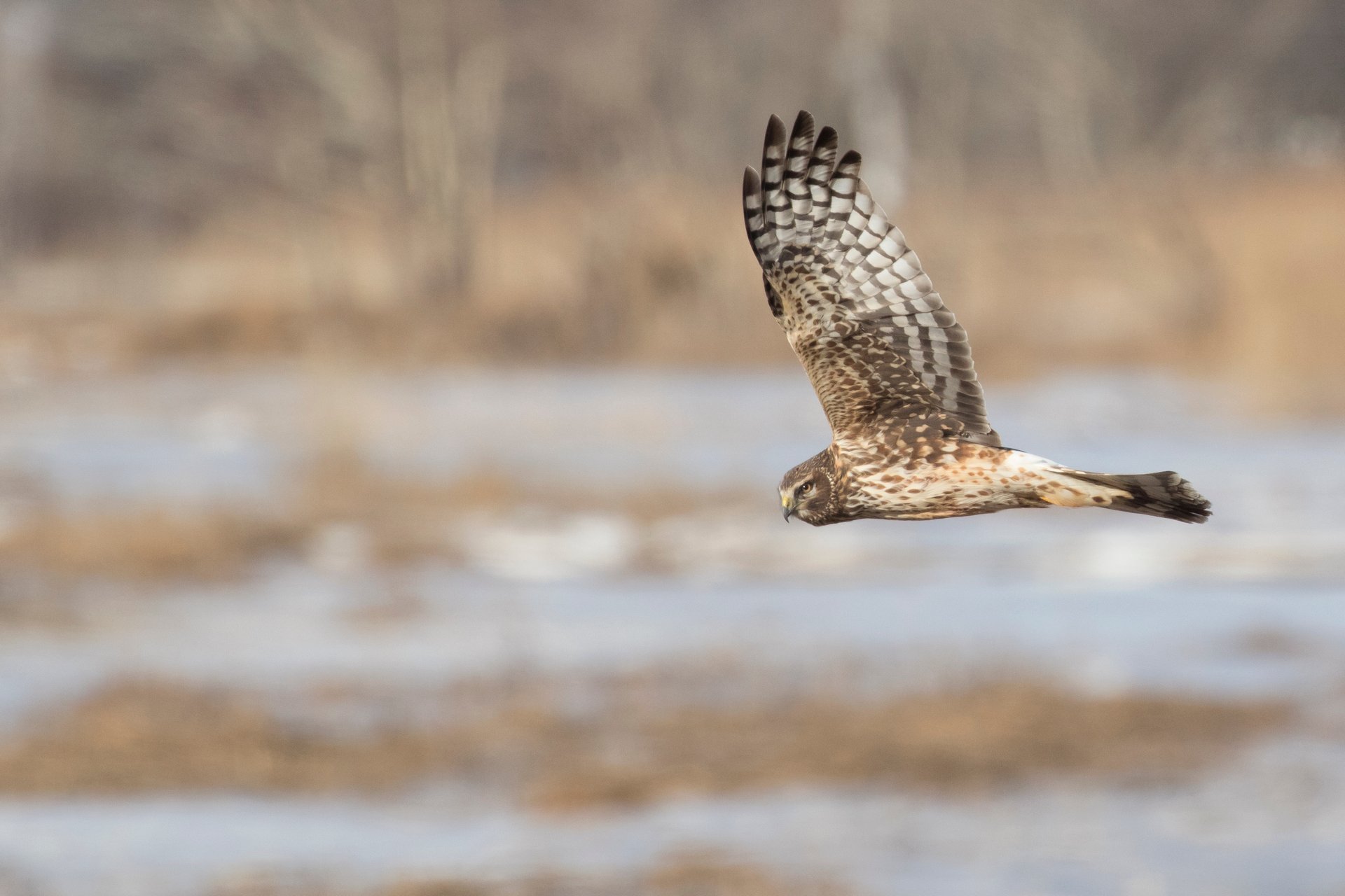
Northern Harrier (Circus cyaneus)
The Northern Harrier is most often seen on the wing as it flies low over open country. Its owl-like face and white rump patch are the best field marks for identification. If you wish to see a Northern Harrier in Massachusetts, head to a location that features areas of open grassland and marsh.
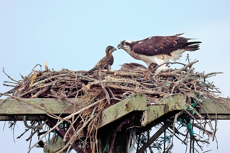
Osprey (Pandion haliaetus)
Also known as the "Fish Hawk" or "Sea Hawk," the Osprey is now a relatively common breeder along the coast with an increasing number at inland locations. Its dramatic black-and-white plumage and long wings make it unmistakable. Osprey feed almost exclusively on fish and can be seen hovering over the water before making a spectacular dive to capture its prey. Learn more about Ospreys
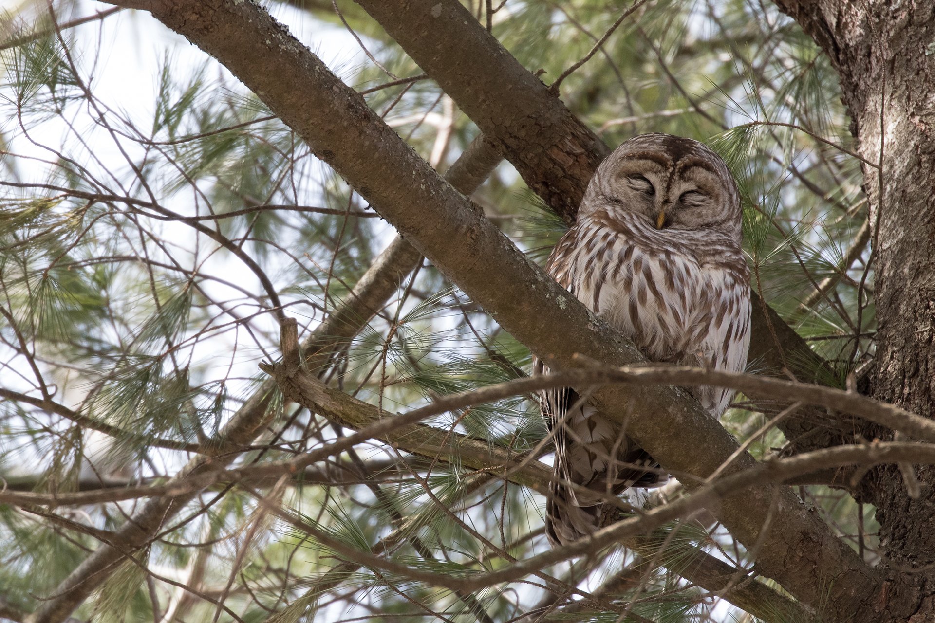
Owls
The only nocturnal bird of prey, owls remain something of a mystery to most people. While difficult to spot, they’re found in all sorts of habitats, including dense forests, wood lots, swamps, marshes, grasslands, and even residential neighborhoods. In Massachusetts, the most common types of owls in Massachusetts include Great Horned Owl, Barred Owl, Eastern-screech Owl, and Saw-whet Owl. Learn more about owls
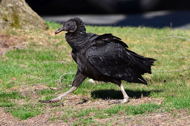
Black Vulture (Coragyps atratus)
The Black Vulture is similar to the more common Turkey Vulture but can quickly be identified by its white wingtips. Mature adults have black faces, unlike the bright red seen on Turkey Vultures. Although still uncommon in most of the state, there are areas in western Massachusetts where Black Vultures are routinely seen—and may well be breeding.
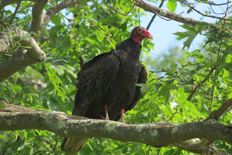
Turkey Vulture (Cathartes aura)
Soaring silently overhead, Turkey Vultures have become a fairly common sight in the Northeast. Whether flying over cities, open fields, or forests, you can identify this species by its distinctive profile—a pronounced dihedral (wings lifted above the body), rocking back and forth in the air currents. Turkey Vultures are one of the earliest migrants to return to Massachusetts, often showing up in late February. Learn more about Turkey Vultures
Hawk Watching
The best time to go hawk watching is during fall migration, which begins peaks in September. During this time, the most numerous hawks are the Broad-winged Hawk, which at times can be seen in flocks, or kettles, of hundreds, occasionally thousands of birds, "boiling" high into the sky. Learn more about when and where to hawk watch
Threats to Birds of Prey
Hawks and other birds of prey are vulnerable to a changing climate, loss of habitat, and ingesting rat poison. Second-generation anticoagulant rodenticides (SGARs) are devastating Massachusetts wildlife. When eagles, hawks, foxes, and other predators consume rodents that have ingested these deadly poisons, they develop uncontrollable bleeding that often leads to slow, painful deaths.
How Mass Audubon Helps Birds of Prey
Protecting birds, wildlife, and habitat has been our core mission for over a century. In addition to protecting resilient lands and fighting the impacts of climate change, Mass Audubon is advocating to tightly regulate the use of SGARs, especially near schools and large campuses where children could be exposed and make a first step towards banning them entirely in Massachusetts. Learn more about our policy priorities
Upcoming Programs
See all programsA Nature Year at Pleasant Valley Wildlife Sanctuary: Summer
-
Pleasant Valley Wildlife Sanctuary, Lenox
-
3 classes starting
Saturday, July 18
9:00-11:00am
Adults
Summer Bird Walk at Belle Isle Marsh, Winthrop
-
Sunday, July 26
8:00-10:00am
Adults
Walk, Wine, and Bird Watch
-
Arcadia Wildlife Sanctuary, Easthampton
-
Sunday, August 23
3:30-6:30pm
Adults
Stay Connected
Don't miss a beat on all the ways you can get outdoors, celebrate nature, and get involved.