

Trails at High Ledges
Explore 5 miles of trails at High Ledges Wildlife Sanctuary. Several trails offer you the opportunity to enjoy the geology, flora and fauna of the sanctuary. Trails are rugged, with no boardwalks or bridges over rough or seasonally wet terrain. Moderate to steep slopes may be encountered on some trails.
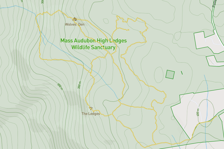
Digital Trail Map
Use your smartphone to navigate the sanctuary. View the map
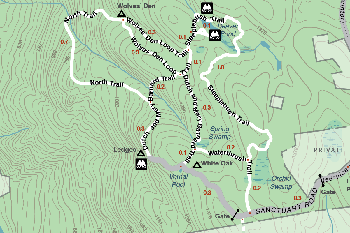
Downloadable Trail Map
Trail Descriptions
Sanctuary Road
Length: 1 mile
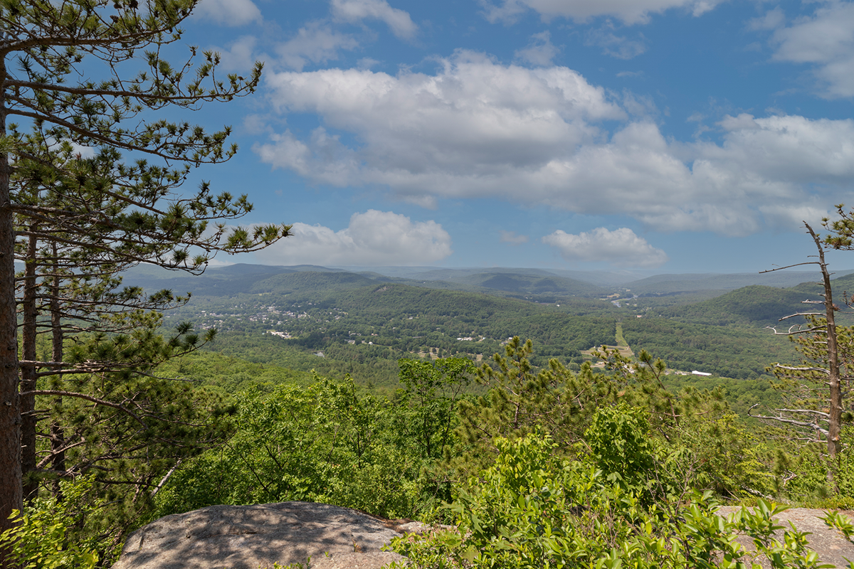
Details: This dirt road (used by Mass Audubon vehicles only), with some hills, leads directly to The Ledges and offers spectacular views of the Deerfield River Valley and Mount Greylock. While walking, take time to watch birds in the small fields, admire the large white oak, or explore the vernal pool.
Dutch and Mary Barnard Trail
Length: 0.7-mile
Details: The most popular trail on the sanctuary is noted for its fine display of spring wildflowers and ferns.
Wolves’ Den Loop Trail
Length: 0.5-mile loop
Details: This extension off the Barnard Trail leads to the Wolves’ Den, a geologic feature where local lore has it that the last wolf in the area lived.
Waterthrush Trail
Length: 0.5 miles
Details: Connecting Sanctuary Road to the Dutch and Mary Barnard Trail, this rolling trail skirts wetlands and stream. Look for the brilliant yellow Marsh Marigold in mid-spring.
North Trail
Length: 0.7 miles
Details: A steep trail with multiple stream crossings follows a portion of a brook through a ravine and passes below numerous ledges. At the halfway point there is an extremely steep section of trail, use caution. Clockwise travel is advised, starting at junction of Dutch and Mary Barnard Trail.
Steeplebush Trail
Length: 1.2 miles
Details: This winding trail meanders by a vernal pool and along rocky ledges. Enjoy three magnificent shoreline views of the beaver pond. There are some slight to moderate slopes.
Navigation Tip
Blue trail markers lead away from the sanctuary road and yellow trail markers lead back.