

Trails at Broad Meadow Brook
Explore 5 miles of trails at Broad Meadow Brook in Worcester, including our 1-mile universally accessible All Persons Sensory Trail.
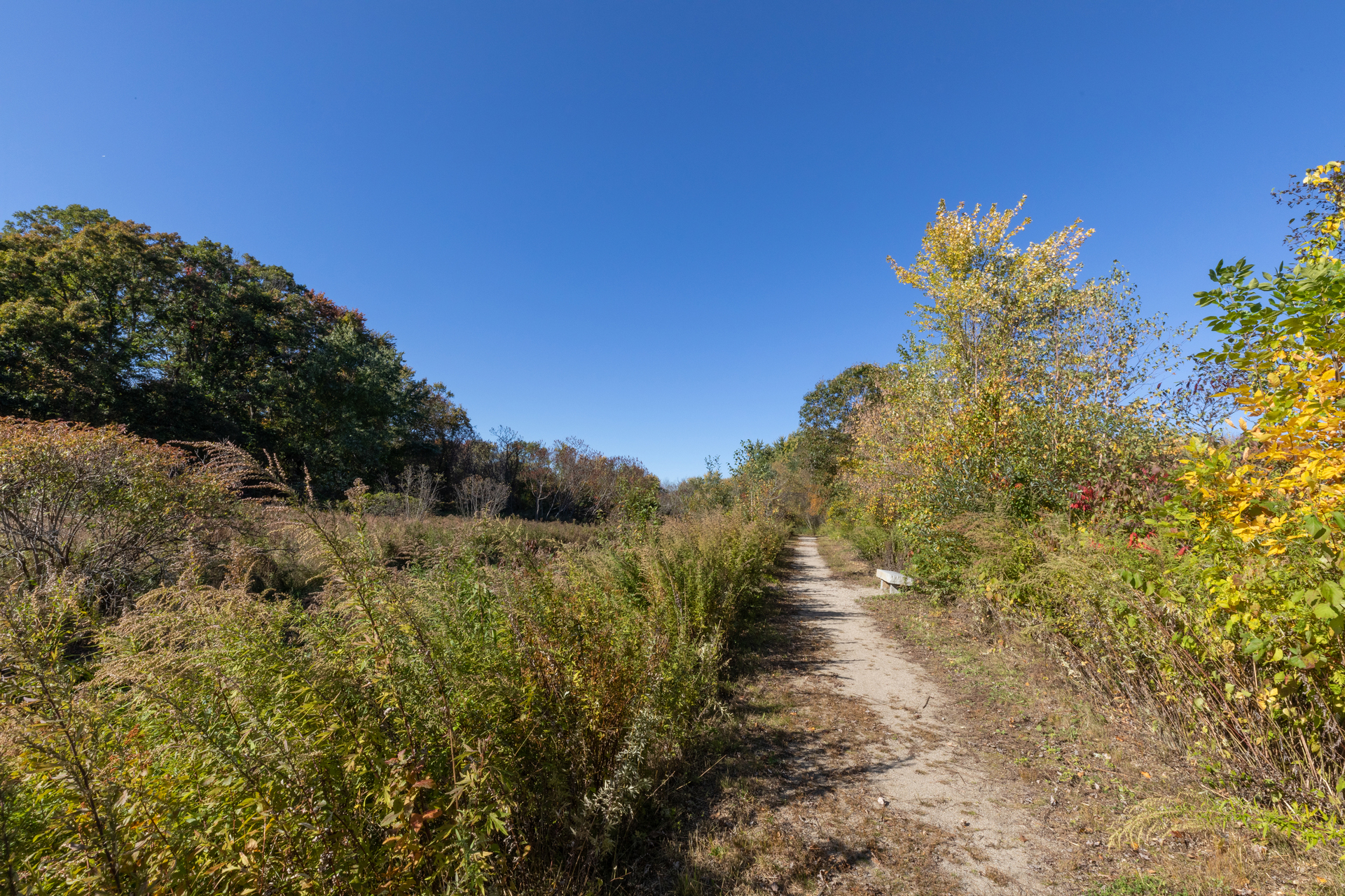
Trail Map
Trail Descriptions
All Persons Sensory Trail
Length: 1 mile (round-trip)
Details: This trail begins at the Visitor Center butterfly garden and continues along portions of the Holdredge and Frog Pond Trails. The surface is packed stone dust with some boardwalk.
Highlights: One of Mass Audubon's ADA-compliant, universally accessible All Persons Trails. It features a rope-and-post guidance system and 14 stops with interpretive information.
Trail booklet & audio tour details
Holdredge Trail
Length: 0.6 miles
Details: The main pathway from the Visitor Center into the wildlife sanctuary core, ending at Sprague Lane Trail. The trail passes through woods, by the Nature Play Area, near a vernal pool, and over Broad Meadow Brook. The surface begins as packed gravel and boardwalk, with benches and a vernal pool viewing deck along the way. Past the stepping-stone brook crossing, the unimproved trail ascends steadily through oak and young sassafras stands.
Highlights: A good trail for all kinds of woodpeckers, Red-eyed Vireos, and Eastern Phoebes. Highbush blueberry indicates nearby hidden Buttonbush Pool, where frogs may be heard in spring and summer.
Frog Pond Trail
Length: 0.2 miles
Details: A level boardwalk, which transitions to packed stone dust near the Sprague Trail junction. The trail passes through wetland and offers excellent birding year-round and butterflies in summer months.
Highlights: Yellow birch, spicebush, and sensitive fern make their home here. The Frog Pond bench is a favorite destination for visitors of all ages.
Enchanted Forest Trail
Length: 0.25 miles
Details: Level and somewhat rocky with short boardwalks. This shady woodland route connects Holdredge and Sprague Trails. A good place to look for signs of wildlife, including deer and bobcat.
Highlights: Stone walls, Shagbark Hickory, and wildlife tracks are abundant here. Look for the natural rock pile and sister trees along the trail. Several kinds of Clubmosses are found closer to Sprague Trail.
Sprague Trail
Length: 0.5 miles
Details: A level trail, packed stone dust from its inception to the brook crossing. Steppingstones cross Broad Meadow Brook, after which the dirt trail ascends a moderately steep slope to the powerline. Beyond the powerline, Sprague Extension Trail (0.5 miles) takes you through upland oak woods and connects to Smiley Face Trail.
Highlights: Excellent wildflowers near the brook, including Bottle Gentian and Tall Meadow Rue. Palm Warblers, Northern Parulas, and Black-and-white Warblers are often spotted during migration from the brook to the powerlines. Eastern Wood-peewees nest near the Extension.
Smiley Face Trail
Length: 0.6 miles
Details: Fairly level trail through upland woods from Sprague Extension to Granite Street, continuing on public land to the Blackstone River Bikeway on Millbury Street.
Highlights: Look for Mourning Cloak butterflies in spring, acorns in late summer, and deer in winter.
Lady Slipper Trail
Length: 0.4 miles
Details: This trail has occasional steep and narrow sections with moderate footing. The trail crosses two seasonal streams with steppingstones and connects Holdredge Trail with Cardinal and Troiano trails.
Highlights: Mountain laurel and mature bigtooth aspen line the trail. Wood Thrushes and Brown Creepers have been seen here. A nice view of the Cattail Marsh is found at the intersection of Troiano and Cardinal Trails.
Blue Well Trail
Length: 0.5 miles
Details: This trail connects Holdredge Trail to Cardinal Trail with a level, packed dirt surface. After two short boardwalks and a brief spur trail sloping up to the powerline, the trail parallels the powerline ridge to meet up with Cardinal and North Link trails.
Highlights: Shady and full of bird life, including Ovenbirds. Look for mountain laurel, American Chestnut sprouts, and interesting fungi.
Powerline Trail
Length: 0.5 miles
Details: Combines moderately steep slopes and level sections. The open land under the power lines showcases grassland habitat.
Highlights: Eastern Towhee, Field Sparrow, Indigo Bunting, and many butterflies and wildflowers are found here in summer. In winter look for animal tracks of all kinds.
Cardinal Trail
Length: 0.8 miles
Details: Moderate footing and gentle to moderate slopes. The trail connects the north and south ends of Troiano Brookside Trail and makes connections with several other trails as it traverses diverse habitat types including wet meadow, managed shrubland, woods, and grassland.
Highlights: Wildlife is abundant in all seasons, especially in the more open habitats. Look for butterflies in Barbara’s Meadow. Eastern Towhees, Blue-winged Warblers and Baltimore Orioles spend spring and summer here; tracks and signs of deer and gray fox can be seen in winter.
Troiano Brookside Trail
Length: 0.6 miles
Details: A fully accessible trail that parallels Broad Meadow Brook. The surface is level, packed stone dust appropriate for strollers and wheelchairs. Handicapped access and parking are at the end of Hampton Street.
Highlights: The trail offers wetland vistas and superb wildlife viewing. Turtles and muskrats are active in the brook. Look for migrating birds and trees cut by beavers.
Sagatabscot Ridge Trail
Length: 1.7 miles
Details: Moderate, sometimes difficult footing. It connects the Visitor Center with Granite Street, following Holdredge, Lady Slipper, and Cardinal Trails, and becoming its own trail as the Cardinal Trail heads into the northern woods. From here, the trail crosses a few small streams and rocky stretches and runs through mature Oak-Savannah habitat.
Highlights: A short spur takes you to Overlook Rock, with a view of the sanctuary grasslands. A small historic quarry is located near the western end. Look for signs of wild turkeys and a variety of fungi.
Piggery Trail
Length: 0.4 miles
Details: Fairly level trail that parallels Granite Street to connect the Sagatabscot Ridge Trail with sanctuary land across from St. Paul Diocesan Jr./Sr High School. Old stone walls and other artifacts testify to a landscape with a history of urban growth and disturbance, in the process of being reclaimed by nature.
Highlights: Wild turkeys and great-horned owls have been heard calling along this shady trail.
Wilson Meadow Link Trail
Length: 0.2 miles
Details: Offers moderate-to-uneven footing. This trail links the Sprague Lane Trail with the meadow behind the Wilson/Rice homestead. The trail begins in floodplain woods then follows along the Red Maple swamp to one of the oldest hayfields in Worcester.
Highlights: Excellent wildlife viewing opportunities along the swamp including Green Herons and Tree Swallows in the summer; large flocks of wood duck in the fall.
North Link Trail
Length: 0.1 miles
Details: A short, steep, wooded trail that connects the south portion of the Cardinal Trail with the Troiano Brookside trail.
Highlights: Large Witch-hazels and Christmas ferns provide serenity but be watchful for poison ivy along the narrower segments. Fishers and turkeys have been reported here.