

Find a Bird
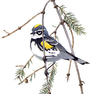
Yellow-rumped Warbler
Dendroica coronata
Somewhat local and likely increasing
“Oh, no! not in spring-time! / Summer, winter or fall! / No, never could I leave you at all!” – Alan Jay Lerner & Frederick Loewe, “If Ever I Would Leave You”
A bird for all seasons, the Yellow-rumped Warbler is the only warbler that can reliably be found in the Bay State year-round. A number of special adaptations make this possible, not the least of which is the bird’s ability to digest the waxy fruits of bayberry and Wax Myrtle. Although noted as a generalist among warbler species, the Yellow-rumped Warbler was still mostly restricted to the western part of the state as a breeder until fairly recently. Coniferous forests are the preferred breeding habitat of the Yellow-rumped Warbler, and the widespread deforestation following European colonization was likely trouble for Yellow-rumped Warblers.
Historic Status
Yet another species with a sea of confusing official and common names, the Myrtle Warbler, as it was formerly known, became a suspected breeder in Massachusetts in the latter half of the nineteenth century, primarily known previous to that time as “among the most abundant of all the migrants who pass through Massachusetts” (Minot 1877). Suspicions of breeding were aroused in the 1870s in Berkshire County, and came to fruition before the turn of the century (Howe & Allen 1901). By the 1920s, Forbush reported them as casually breeding as far east as eastern Worcester County, as well as spending the summer in some locales in the eastern part of the state south to Plymouth County (Forbush 1929). As reforestation occurred throughout Massachusetts, the species gradually descended from mountainous breeding areas to also inhabit woods at lower altitudes.
Atlas 1 Distribution
Yellow-rumped Warblers were concentrated in western Massachusetts but had begun appearing in more easterly climes as well, during Atlas 1, and they posted 25% block occupancy statewide. The western regions had plenty of occupied blocks; indeed, the Taconics, Marble Valleys, Berkshire Highlands, and Lower Berkshire Hills accounted for 47% of the species’ statewide range. The species’ breeding distribution thinned across the Berkshire Transition and Vermont Piedmont, and the rich lowlands of the Connecticut River Valley. By contrast, the mixed forests of the Worcester Plateau proved to be excellent Yellow-rumped Warbler habitat, with 68% block occupancy. Yellow-rumped Warblers were thinly distributed in mixed or coniferous forests across the Coastal Plains, and the interface of the Bristol/Narragansett Lowlands and the Cape and Islands played host to a cluster of breeding blocks among the Pitch Pines of those ecoregions.
Atlas 2 Distribution and Change
Atlas 2 showed Yellow-rumped Warblers solidifying their breeding footprint in western Massachusetts, and making inroads as a breeder in the eastern reaches of the Commonwealth, overall reaching 34% block occupancy statewide. The western regions showed mixed results, with some regions posting net losses and some net gains. The Marble Valleys lost a string of blocks, along with the Taconics, but both the Berkshire Transition and Connecticut River Valley saw slight upticks in the distribution of breeding. Both Worcester Plateau regions also posted positive trends. The expanding front of the species’ range extended into the Coastal Plains and beyond, including an aggregation of breeding activity in well-surveyed Essex County and a Confirmation in the Boston Basin. Although present in the southeast, Yellow-rumped Warblers appeared to be struggling to persist in only a few scattered blocks.
Atlas 1 Map
_BBA1.jpg)
Atlas 2 Map
BBA2.jpg)
Atlas Change Map
_Change.jpg)
Ecoregion Data
Atlas 1 | Atlas 2 | Change | ||||||
Ecoregion | # Blocks | % Blocks | % of Range | # Blocks | % Blocks | % of Range | Change in # Blocks | Change in % Blocks |
Taconic Mountains | 11 | 68.8 | 4.5 | 12 | 48.0 | 3.4 | -1 | -6.7 |
Marble Valleys/Housatonic Valley | 26 | 66.7 | 10.7 | 22 | 56.4 | 6.3 | -4 | -10.3 |
Berkshire Highlands | 50 | 90.9 | 20.7 | 49 | 89.1 | 14.1 | 4 | 7.5 |
Lower Berkshire Hills | 27 | 96.4 | 11.2 | 27 | 87.1 | 7.8 | -1 | -3.7 |
Vermont Piedmont | 8 | 47.1 | 3.3 | 10 | 58.8 | 2.9 | 2 | 16.7 |
Berkshire Transition | 13 | 34.2 | 5.4 | 27 | 67.5 | 7.8 | 6 | 19.4 |
Connecticut River Valley | 9 | 16.1 | 3.7 | 20 | 30.8 | 5.7 | 5 | 10.4 |
Worcester Plateau | 53 | 67.9 | 21.9 | 86 | 97.7 | 24.7 | 4 | 8.3 |
Lower Worcester Plateau | 24 | 32.4 | 9.9 | 45 | 56.3 | 12.9 | 11 | 20.4 |
S. New England Coastal Plains and Hills | 13 | 4.8 | 5.4 | 44 | 15.5 | 12.6 | 20 | 8.8 |
Boston Basin | 0 | 0.0 | 0.0 | 2 | 3.6 | 0.6 | 4 | 7.3 |
Bristol and Narragansett Lowlands | 3 | 2.8 | 1.2 | 3 | 2.6 | 0.9 | 0 | 0.0 |
Cape Cod and Islands | 5 | 3.7 | 2.1 | 1 | 0.7 | 0.3 | -3 | -2.5 |
Statewide Total | 242 | 25.0 | 100.0 | 348 | 33.6 | 100.0 | 47 | 5.7 |